Custom Maps. We make it easy.
Our team at Mapping Solutions is ready for almost any mapping project, large or small. Whether you need one map or one thousand, our experienced cartographers build to your exact specifications - roads, landowners, topography, aerial imagery, or any other feature your project requires. Many custom maps use our existing plat data as a base layer, so you’re never starting from scratch.
Need a digital version for your phone or tablet? Every map we build is also available as a georeferenced digital file.
Most custom maps are quoted within 1-2 business days and typically ship in 2-3 weeks, depending on complexity and size.
Request your free, no-obligation quote →
Here are some examples, but we are ready to map new territory!
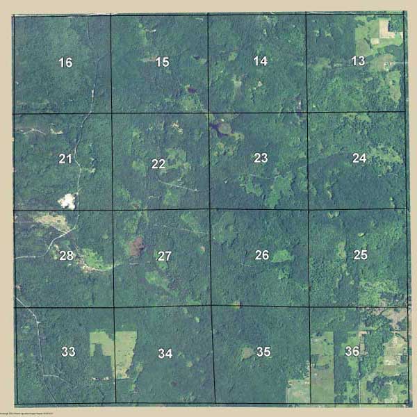
Aerial Map
Get an aerial wall map of your property, centered and highlighted exactly how you want it. Multiple sizes and paper options available.
Map My Property →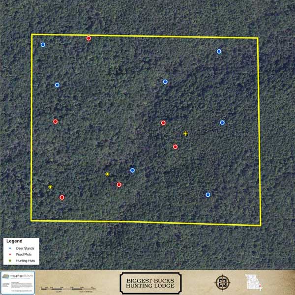
Hunting Lodge Map
A high-resolution aerial map of your hunting property, with the features you choose - trails, stands, food plots, boundaries. Available as a SmartMap for your phone too.
Map My Hunting Lodge →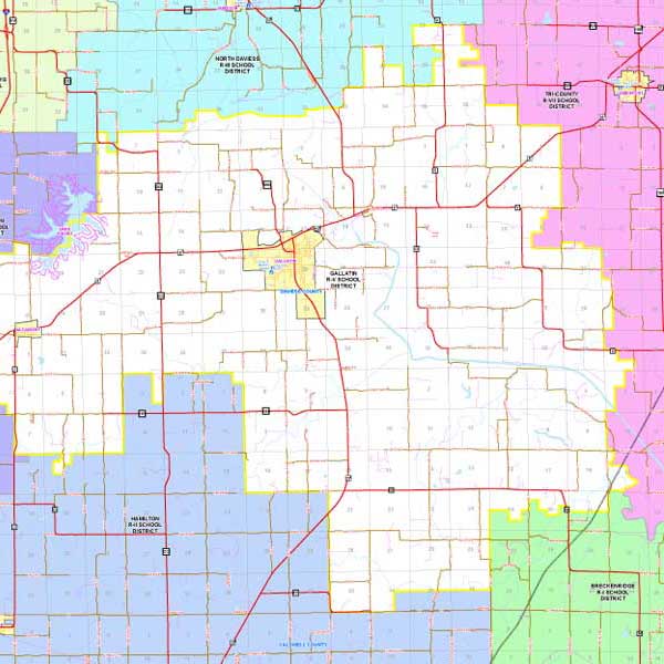
District Map
School districts, fire and ambulance districts, voting districts, or any other defined area - built and labeled exactly to your specifications.
Quote My District Map →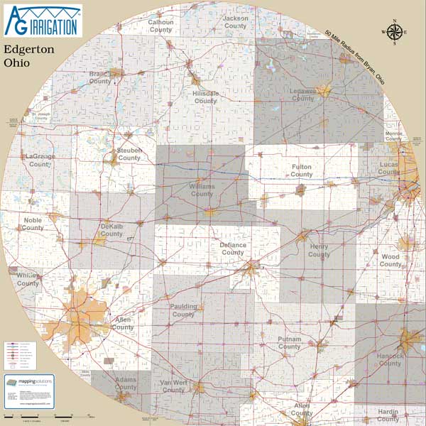
Radius Map
Tell us a location and we’ll build a radius map from that point - ideal for delivery areas, service-area planning, or cost analysis.
Build My Radius Map →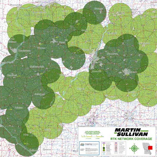
Coverage Area Map
Show one radius or several, or any combination of coverage zones. Built to your specifications for analyzing reach, service areas, or market coverage.
Map My Coverage Area →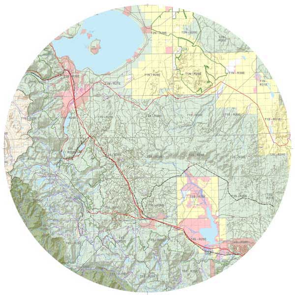
Topographical Map
Custom topo maps with any features you select. Enhanced LiDAR (3D elevation effect) now available in many areas.
Quote My Topo Map →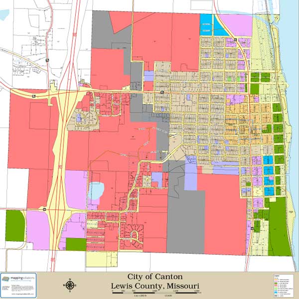
City Map
The same city maps featured in our plat books, resized and customized for quick, standalone reference. Additional features can be added.
Request My City Map →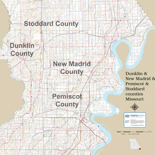
Multi-County / Township Maps
Operating across more than one county, or need a single large-format township view? These run large-format - typically 36" × 36" or 36" × 42" - and are built for offices, branch locations, or service-area planning.
Quote My Multi-County Map →