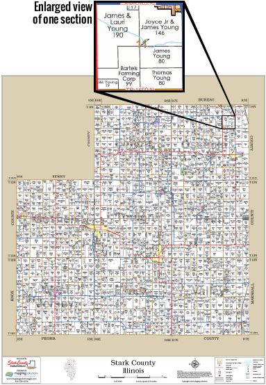
Our County Wall Maps combine landownership detail contained within the plat book to provide an entire view of the county. These large maps include highways, roads, townships, section numbers, range numbers and other geographic features. Property boundaries, landowner names or initials and acreage information are shown for the rural areas.
We also produce other maps, such as School Districts, Fire Districts and Aerial Views in a Wall Map version as well as Custom Maps with all of the information you need. Call now for a free estimate to see how we can design just the right Custom Map for you.
Map size is typically 36" X 48" but can vary depending on the size and shape of the county.
We offer four types of paper for our wall maps, Standard, Premium Premium Photo Matte, Water Resistant & Peel & Stick.
- Standard Wall Maps are printed in color on heavy 32 lb. High Resolution Coated Bond paper for durability and appearance.
-
Premium Photo Matte Paper – A beautiful, long-lasting image for your Wall Map, great for wall display or framing.
-
Deluxe Water Resistant Paper – A light, durable, and flexible synthetic paper option that holds up well to repeated use and abuse, whether hanging on a wall or in the field. Even after stored rolled up for months, it still lays flat.
-
Peel & Stick Repositionable Media – An easy to hang paper option that can be applied, removed, and reapplied directly to most wall surfaces without damaging the paper or the surface to which it is applied. Can be applied to foam core board for easel display.

