
Custom Aerial Maps
Posted by Anika Imam, GIS Specialist on 11th Mar 2025
Custom Aerial Maps – An Essential Tool for Every Land Owner
Our Custom Aerial Maps offered by Mapping Solutions are made-to-order, high resolution property maps that are designed with the landowner’s needs in mind. We acquire official parcel boundaries in digital file format from the county assessor, and use the latest satellite imagery from either ESRI World Imagery, or USDA National Agricultural Imagery Program (NAIP), employing Geographic Information Systems to create personalized maps of each property. These are in turn a fantastic portrait to display at home on the wall, or use as a handy map on the ranch for hunting and other recreational activities. We offer two main sizes, 11x17 or 36x36, printed on high quality and durable, premium paper, but are always able to customize the size based on the customer’s preferences.
Personalized Process
We contact our customers’ directly when designing their map, in an efficient, step-by-step process that includes their personal input. We value that all of their important information is correct, such as the parcel boundaries, acreage and deed names; as well to make sure any of their points of interest and landmarks are included, such as fence lines, trails, sheds, trees and roads. We can label adjacent roads, and add essential cartographic tools, such as verbal, ratio and graphic scales, as well as their personalized title of choice.
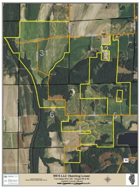
A personalized aerial map with road labels, section grid and numbers, and scale bar.
“Leaf-Off” vs. “Leaf-On”
Some of our customers’ prefer the aerial images to display a particular season, such as fall or spring, and if available, we can provide that, too. Often times, a rancher or hunter would like a “leaf-off” autumn image, so they can see a trail better, or identify points of their land more clearly, such as where deer may reside, or a shed. Others love the lush, green “leaf-on” images, which are taken during the agricultural growing season, and presents the natural beauty of their property.


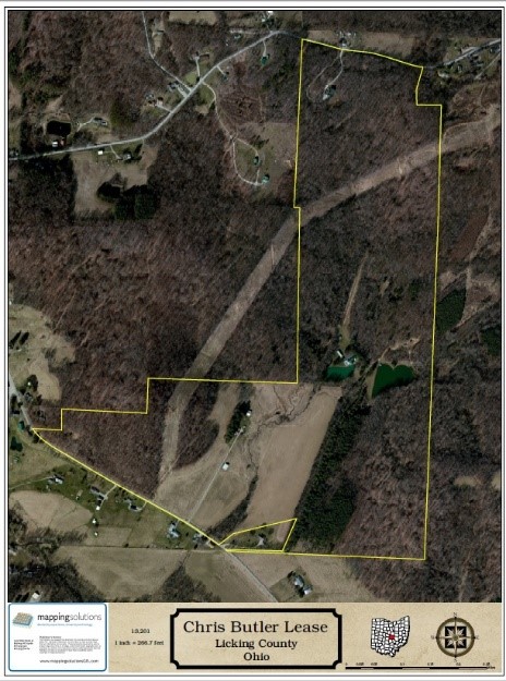
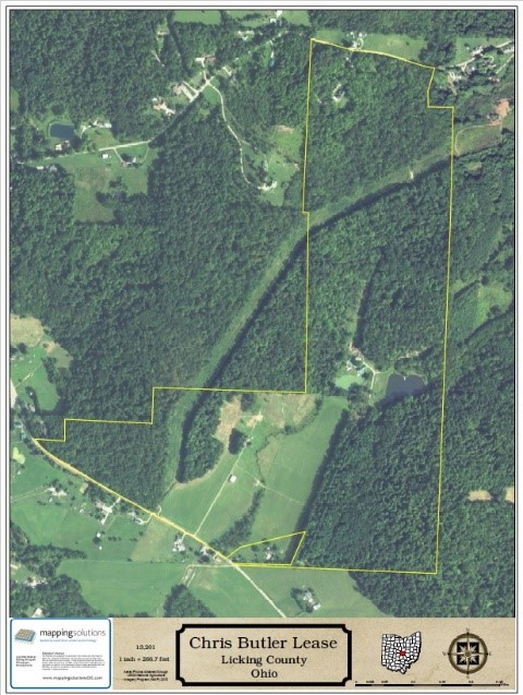
“Leaves-Off” “Leaves-On”
All in all, custom aerial maps are an essential tool for landowners of all property sizes (we have created them for land under 1 acres up to 640 acres and more!), a great gift for a loved one, company, or for your own functional needs regarding your property.